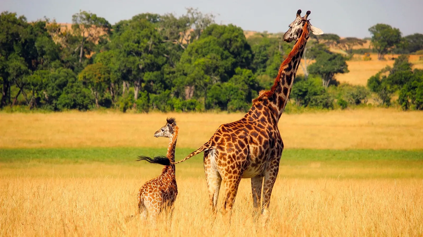
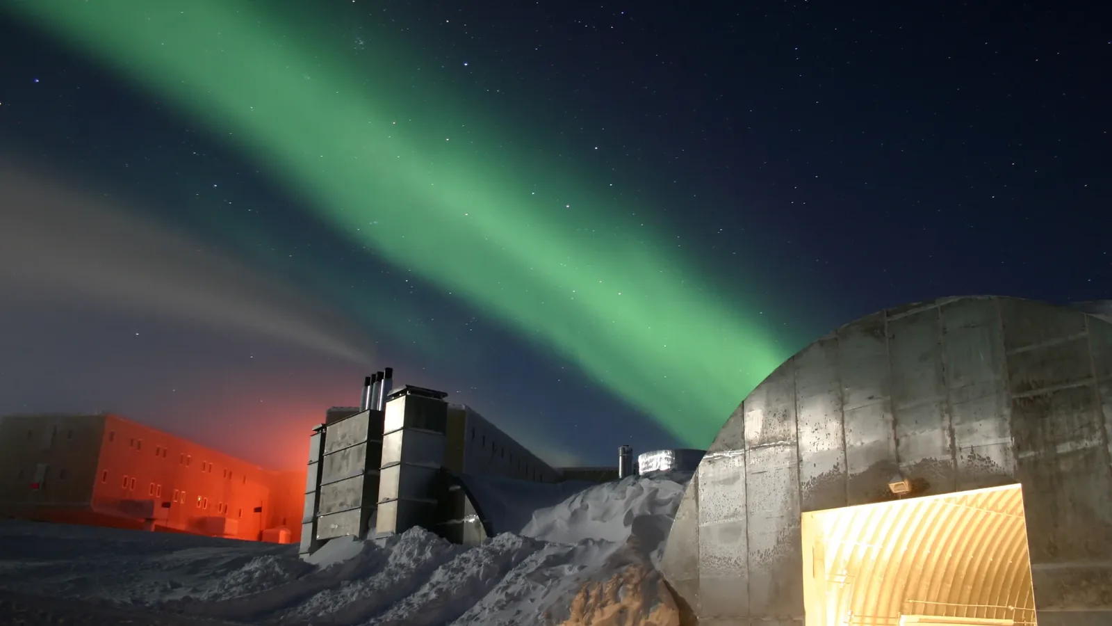
At the bottom of the world, a camera on the roof of a science building photographs a research station that spends half of every year in darkness. At the top, another looks out from a mountain observatory over an Arctic fjord.
On an island in the South Pacific that most people have never heard of, a camera watches a volcano. And on the floor of the same ocean, more than a mile and a half down, another switches on for five minutes every hour in water that never sees daylight.
We set out to find the cameras sitting at the very edges of the planet. The first version of this article found four. When we checked it again, two of them turned out not to be the extremes we had claimed. So we rebuilt it from scratch, and added two more directions while we were at it: up and down.
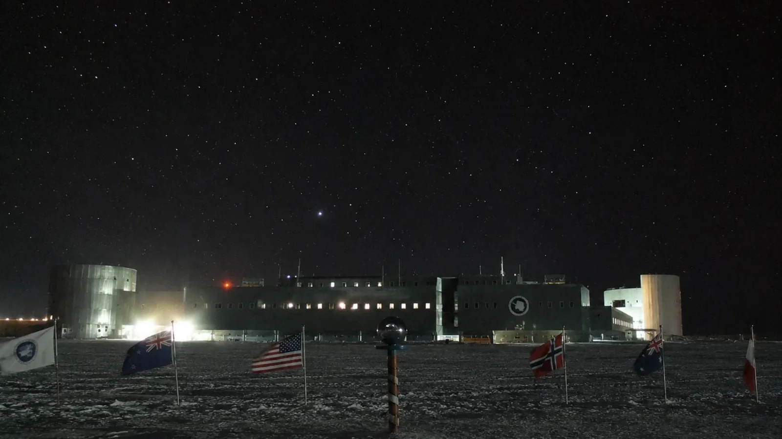
Illustration: EarthLive.TV
"Most northern" sounds simple until you try to prove it, so we set ourselves six rules. The short version: public cameras only, still images count, they have to be reliable and fixed, east and west are measured by longitude, and "on Earth" means on or below the surface.
How This List Works6 rules
First, the camera has to be publicly viewable, with no login. We checked each camera against its operator's own page. A listing on a third-party webcam directory was not treated as proof that a camera exists or works.
Second, auto-updating still images count. Many cameras at the edges of the planet send a fresh photo every 10 or 15 minutes, because there is no connection capable of carrying a video stream. We say which is which.
Third, it has to be reliable. We picked cameras with a long record of working, not ones that happen to be on today. The polar cameras on this list have been recording for years, and where one of our picks was down while we checked, we say so. Several remote cameras would beat our picks on paper, but they drop out for long stretches, and a record that only holds on a good day is not much of a record. We name them where they come close.
Fourth, it has to be a fixed camera. Research ships, submersibles and aircraft stream from far more extreme places, but they move, and a moving camera can claim almost any record for an afternoon.
Fifth, east and west are measured by longitude, with the 180° meridian as the edge. The U.S. Geological Survey uses the same convention to define America's own easternmost and westernmost points. It gives one clear answer for each direction.
Sixth, "on Earth" means on or below the surface. The International Space Station has cameras, but it is not on Earth. Highest means the highest fixed camera on land. Lowest means the deepest fixed camera below sea level, which puts it under the ocean.
Before We Start: The Line Where East Meets West
Lines of latitude measure how far north or south you are. The equator is zero, the North Pole is 90 degrees north and the South Pole is 90 degrees south.
Lines of longitude measure how far east or west you are. They start at zero in Greenwich, London, and run around the world in both directions until they meet at 180 degrees, in the middle of the Pacific Ocean.
That meeting point is the edge of the map. Go a fraction past it heading west and you are suddenly in the far east.
The International Date Line mostly follows that 180° line, bending around island groups and borders. The Diomede Islands in the Bering Strait show how strange that gets.
Little Diomede belongs to the United States and Big Diomede to Russia. They are about 2.4 miles apart, with the date line running between them.
Big Diomede is almost a full day ahead: 21 hours in winter and 20 in summer, when Alaska moves its clocks forward. Little Diomede had 77 residents in 2023. Big Diomede has none.
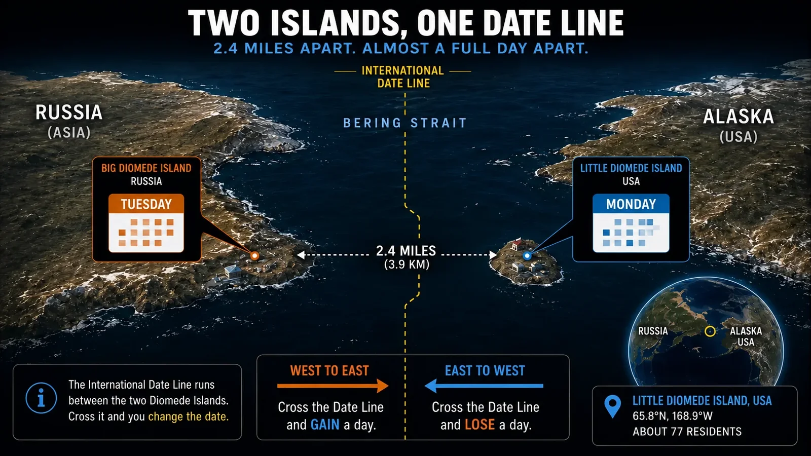
Illustration: EarthLive.TV
The first version of this article, published back in May 2026, called a camera on Little Diomede the easternmost webcam on Earth. By longitude, it is not.
Little Diomede sits at about 168°55′W, west of Greenwich, and Midway Atoll, our old westernmost pick, is further west still. That left two western cameras and no eastern one. This version fixes it.
Northernmost - Ny-Ålesund, Svalbard, Norway
78.9°N | STILL IMAGE, NORMALLY UPDATED EVERY 10 MINUTES
The northernmost reliable public webcam we could verify is at the Zeppelin Observatory, on Zeppelin Mountain above the research settlement of Ny-Ålesund in Svalbard, Norway.
The observatory sits about 1,550 feet (470 m) up, deliberately placed above the local inversion layer, so pollution from the settlement below barely reaches its instruments.
It is owned by the Norwegian Polar Institute, with the Norwegian Institute for Air Research coordinating the science. It opened in 1990, and a new station replaced the original building in May 2000.
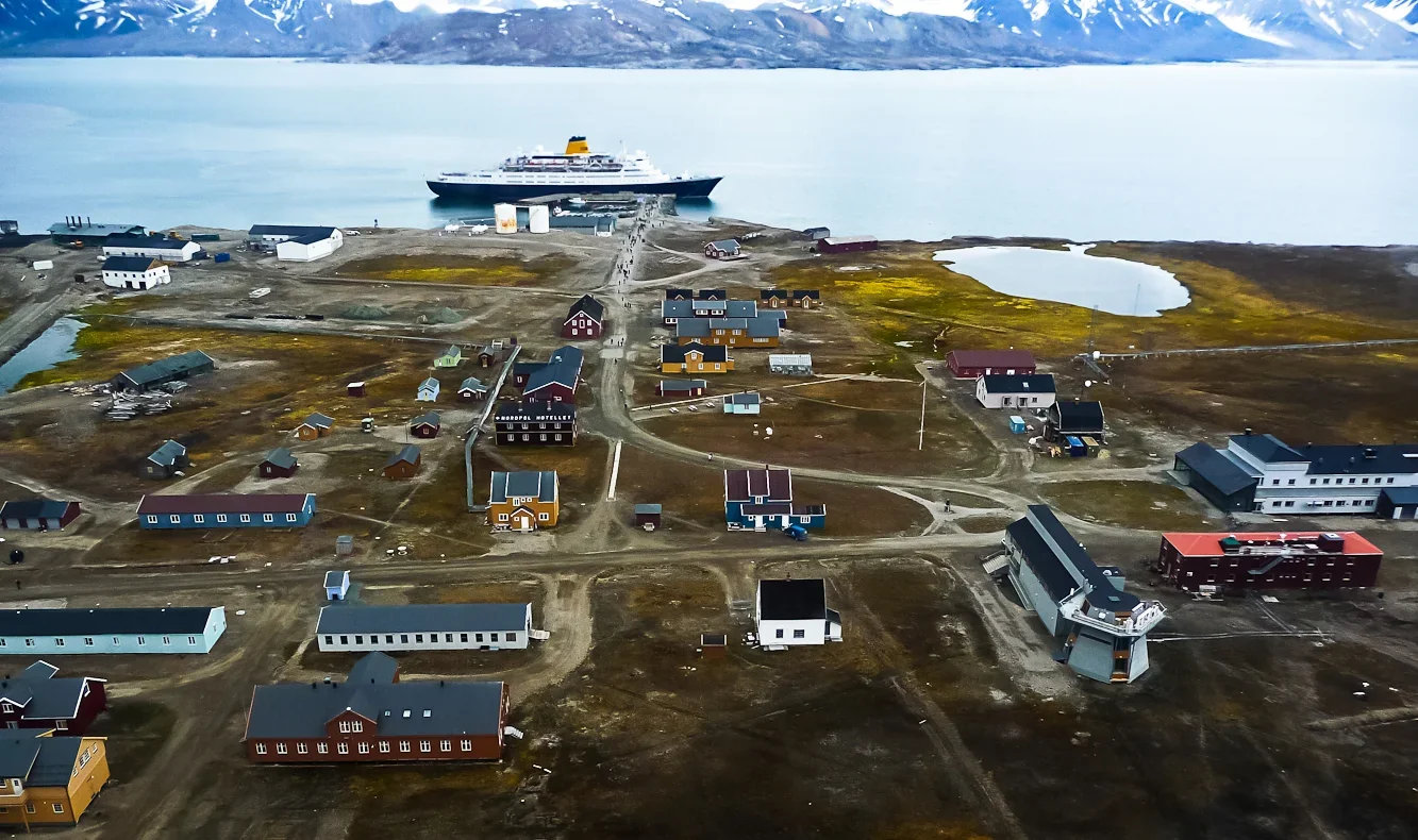
Photo: Daniele1357 / Wikimedia Commons (CC BY-SA 3.0)
Its job is measuring the Arctic atmosphere, including greenhouse gases and pollutants carried north from thousands of miles away. The webcam is a side effect.
The Ny-Ålesund Research Station lists it as a live webcam updated every ten minutes, and it has done that for years.
But while we were finishing this article, its latest image froze on 6 October 2026. Keeping a camera running on an Arctic mountainside is not easy.
Why nothing further north? Alert, in Nunavut, is the northernmost permanently inhabited place on Earth, at 82.5°N, and Villum Research Station in North Greenland sits at 81.6°N. We could not find a public webcam at either.
Several webcam directories list a “Eureka” camera that looks as though it belongs to the Canadian Arctic base of the same name. The one we checked turned out to be in Eureka, California.
In fairness, Zeppelin is not quite the most northerly camera in Ny-Ålesund. An all-sky camera at the AWIPEV observatory and two cameras on the Sverdrup building sit in the settlement below, about a mile further north.
The all-sky camera points straight up at the sky, and we picked Zeppelin because it actually shows you the place.
Southernmost - Amundsen-Scott Station, Antarctica
90°S | STILL IMAGE, UPDATED EVERY 15 MINUTES WHEN A SATELLITE IS AVAILABLE
The camera sits on a research building a short walk from the geographic South Pole, about as far south as a camera can go. At 90 degrees south, every direction you face is north.
It is run by NOAA from the roof of the Atmospheric Research Observatory, a building that samples some of the cleanest air on the planet.
It photographs the elevated station every 15 minutes, as long as a relay satellite is overhead to send the picture out.
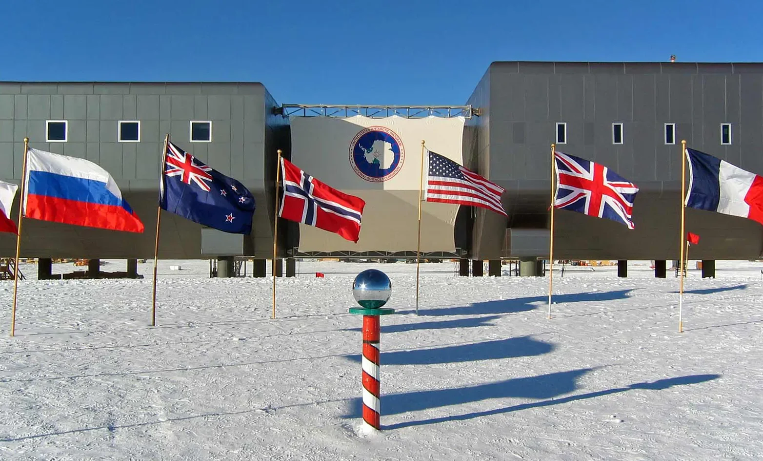
Photo: U.S. Antarctic Program / National Science Foundation
The sun sets here around late March and does not rise again until around late September.
Twilight lingers for weeks either side, and through the depths of winter the only natural light in the pictures comes from the moon and the aurora australis.
In 2024 the sun rose on 20 September, and NOAA’s station chief, Krystian Kopka, marked its return after six months of darkness.
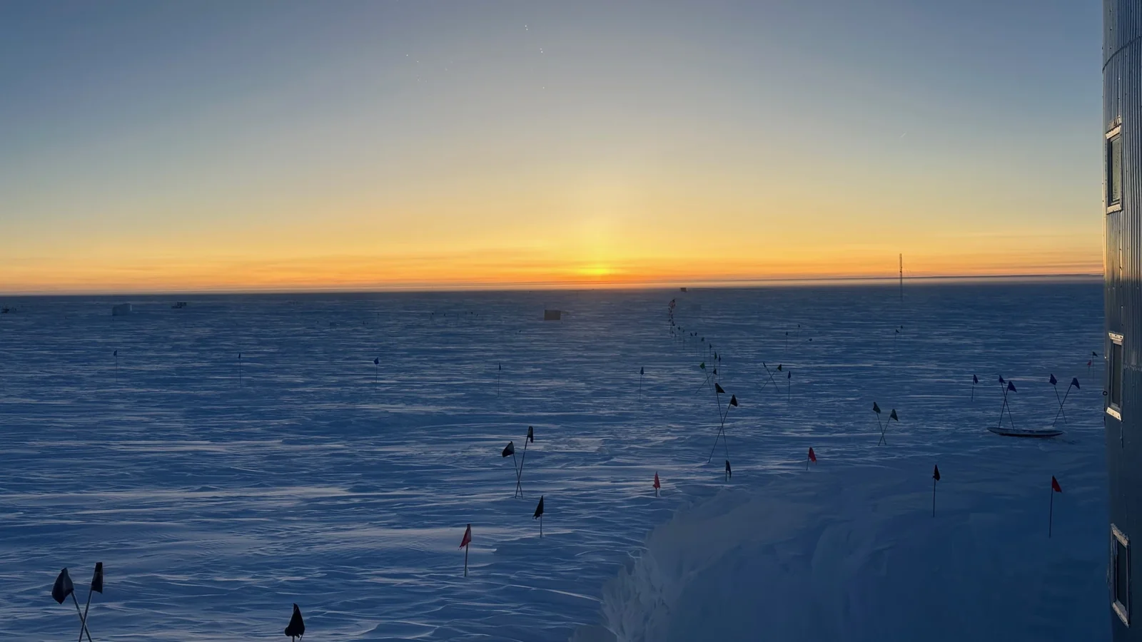
Photo: Krystian Kopka / NOAA
Roald Amundsen’s team reached this spot in December 1911. Robert Falcon Scott’s arrived in January 1912. Now anyone can see it four times an hour, satellite permitting.
The South Pole camera also features in our 5 of the Loneliest Live Webcams on Earth.
Is it also the coldest webcam on Earth? Probably, but the South Pole is not the coldest place on Earth.
That record belongs to Russia’s Vostok Station, higher on the Antarctic plateau, where the lowest air temperature ever directly measured on Earth was recorded in July 1983: minus 128.6°F (minus 89.2°C).
We could not find a public webcam at Vostok, or at the French-Italian Concordia Station at Dome C. That makes this the coldest public webcam we could verify.
Easternmost - Wainui Beach, Gisborne, New Zealand
178.08°E | LIVE VIDEO
The easternmost reliable public webcam we could verify, measured by longitude, was not built for science. It was built so surfers could decide whether it was worth driving to the beach.
The Wainui Beach surf cam is a free stream run by Blitz Surf Shop in Gisborne, on the east coast of New Zealand’s North Island.
It looks out over one of the country’s best-known beach breaks at 178.08 degrees east, less than two degrees short of the 180° line.
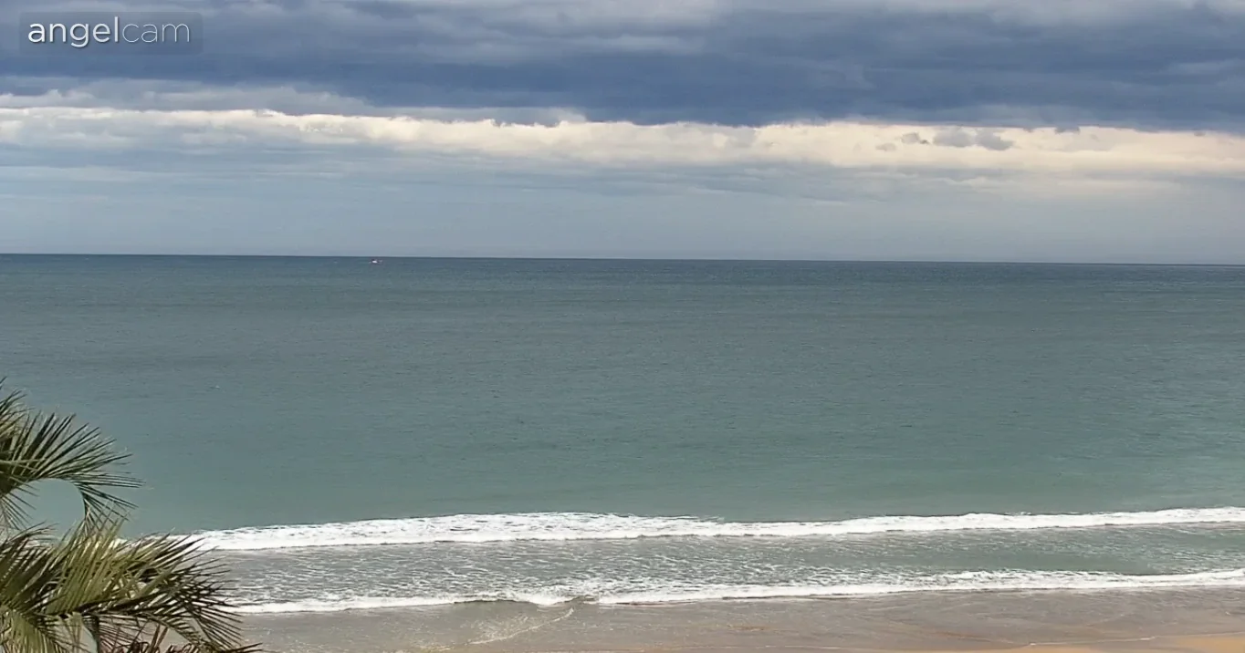
Photo: Blitz Surf Shop
Could anything beat it? On paper, yes. The Alaska Volcano Observatory has cameras on Little Sitkin and Semisopochnoi in the western Aleutians, at about 178.5°E and 179.6°E. Both are further east than Wainui.
They send still images when they are working, but they drop out for long stretches, and most were not updating when we checked. Wainui streams live video and keeps the title on reliability.
The 180° meridian also runs straight through Taveuni in Fiji, and Funafuti, the capital of Tuvalu, sits at 179.2°E. We could not find a working public webcam in either place.
Westernmost - Raoul Island, New Zealand
ABOUT 177.9°W | STILL IMAGE, UPDATED EVERY 10 MINUTES
Cross the 180° line from Wainui Beach and you are in the far west. The westernmost reliable public camera we could verify belongs to New Zealand too.
Raoul Island lies about 680 miles (1,100 km) northeast of Auckland in the Kermadec Islands.
It is not really an island in the ordinary sense. It is the summit of a large active volcano, which last erupted in March 2006. Ngāti Kuri, the mana whenua, call it Rangitāhua.
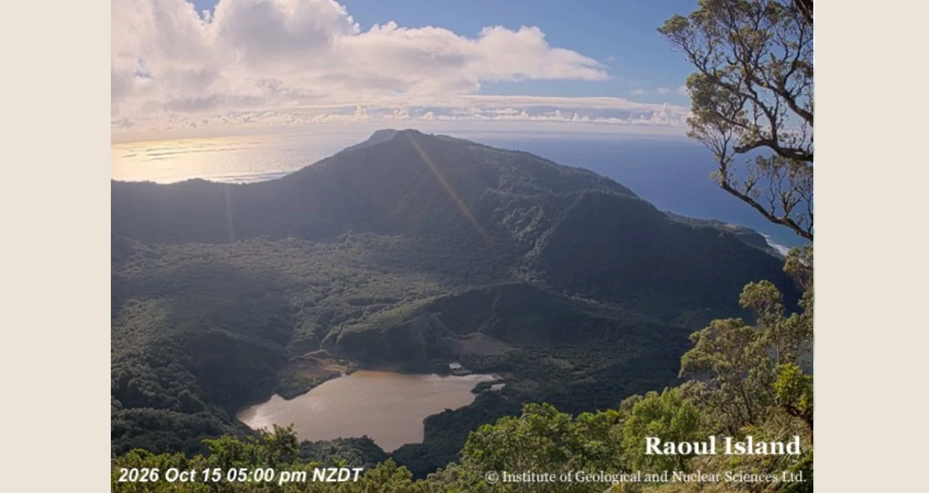
Photo: GeoNet / GNS Science
GeoNet, New Zealand’s geological hazard monitoring service, runs a camera there to watch the volcano and help keep staff on the island safe.
Raoul is also an important station for detecting earthquakes and tsunami across the Pacific. GeoNet shares the island with the Department of Conservation, MetService and the U.S. Geological Survey.
The camera produces an image every ten minutes, and on 15 October 2026 it was posting them on schedule.
Could anything beat it? Possibly. The Alaska Volcano Observatory has a camera pointed at Gareloi in the Aleutians, at around 178.8°W, but it was offline when we checked, and we could not confirm exactly where it is mounted.
A webcam directory also lists a camera at a resort on Taveuni in Fiji, where the 180° line runs through the island, but we could not confirm a working feed from the operator.
The runner-up is the better watch. Midway Atoll, at about 177.4°W, falls roughly half a degree short. Its camera, run by the nonprofit Friends of Midway Atoll, streams live video around the clock over the atoll’s albatross colony.
It went public in late 2025, and nearly 70 percent of the world’s Laysan albatrosses and almost a third of the world’s black-footed albatrosses nest on the atoll. If you only open one Pacific camera from this article, open this one.
The twist. The easternmost and westernmost reliable cameras we could verify are both in New Zealand, about four degrees of longitude apart, on opposite sides of the line where the map folds back on itself. East, followed far enough, becomes west.
Highest - Everest Web Cam, Nepal
ABOUT 18,370 FEET (5,600 M) | STILL IMAGE, DAYLIGHT HOURS
The highest fixed webcam we could verify is pointed at the highest point on Earth.
The Everest Web Cam sits near Kala Patthar, about 7 miles (11 km) from Everest. It is linked to two Italian research groups, EvK2CNR and EvK2Minoprio, working with the Nepal Academy of Science and Technology.
Their pages differ on the details. EvK2CNR puts the camera at 5,600 meters (about 18,370 feet) and dates the current setup to a 2023 upgrade. EvK2Minoprio gives about 18,620 feet (5,675 m) and says it was switched on for the COP27 climate summit in 2022.
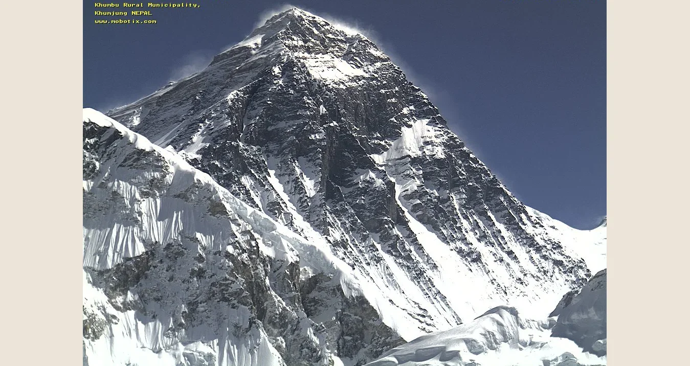
Photo: EvK2CNR
The camera runs on solar power and sends its pictures out over a two-step microwave radio link via the Pyramid, a research laboratory about 16,570 feet (5,050 m) up.
The view takes in Everest’s summit pyramid, from the shoulder at about 24,600 feet (7,500 m) to the South Col at about 26,250 feet (8,000 m), along with the South Summit and the Hillary Step.
It is not just a pretty picture. EvK2CNR says the camera helps helicopter pilots judge whether rescue flights above about 23,000 feet (7,000 m) are possible, and supports research into winds at summit level.
Two caveats come from the operator. The camera goes into standby at night and whenever there is too little light, to save its batteries. And during the monsoon, roughly June to September, the mountain is often hidden in cloud.
The runner-up. The European Southern Observatory runs a live view of the ALMA telescope array on the Chajnantor plateau in Chile, at about 16,400 feet (5,000 m).
The plateau is one of the driest places on the planet, which is exactly why telescopes are there: water vapor absorbs the faint signals from space they are trying to catch.
Lowest - Cascadia Basin, Canada
ABOUT 8,730 FEET (2,660 M) DOWN | LIVE FOR FIVE MINUTES EVERY HOUR
The deepest fixed public camera we could find sits on the abyssal plain of the Juan de Fuca Plate, in the northeast Pacific, off Vancouver Island in Canada.
It is the deepest site operated by Ocean Networks Canada, more than a mile and a half below the surface.
It is wired to NEPTUNE, a loop of fiber-optic cable roughly 500 miles (800 km) long that carries power and data to hundreds of instruments on the seabed. Ocean Networks Canada has run it since 2009.
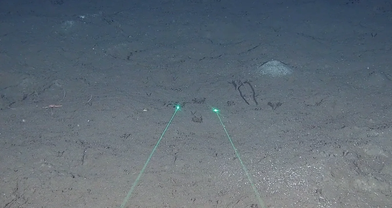
Photo: Ocean Networks Canada
The water here stays at a nearly constant 36°F (2°C). It is so dark and stable that the site has been chosen for a planned neutrino telescope, the Pacific Ocean Neutrino Experiment.
The lights are not left on. The camera runs for five minutes every hour, on the hour, and then the seabed goes back to total darkness.
The runner-up. Ocean Networks Canada’s own Endeavour cameras, about 7,550 feet (2,300 m) down on the Juan de Fuca Ridge, film hydrothermal vents for four minutes every four hours.
Further south, about 250 miles off Oregon and roughly a mile down, the Ocean Observatories Initiative streams HD video of a venting chimney for 14 minutes every three hours.
For more of the world beneath the waves, see our live underwater cams.
What We Could Not Find
The Six at a Glance
Why These Cameras Matter
Most of these cameras were not installed for an audience. Five sit at scientific or hazard-monitoring sites. One was put up so surfers could check the waves.
That is the pattern at the edges of the planet. Nobody puts a webcam at the South Pole, on an active volcano or on the floor of the Pacific for entertainment. It goes there because someone needs to know what is happening, and the rest of us get to look over their shoulder.
Open all six in separate tabs and you are watching the planet from its outermost edges at the same time: the Arctic, the Antarctic, both sides of the date line, the face of Everest and the bottom of the Pacific.
Explore more live cams on our Live Webcam Map, or browse by category and country.
 Take Me Anywhere
Video Transcript About 160 words
The video has no voiceover. The text below appears on screen exactly as shown.
#1 Northernmost - NY-ALESUND CAMERA - 78.907°N 11.888°E
Zeppelin Observatory in Svalbard, Norway is Earth's furthest northern camera anyone can watch. Credit: Norwegian Polar Institute
#2 Southernmost - AMUNDSEN-SCOTT CAMERA - 90.000°S
Amundsen-Scott Station in Antarctica sits at the southernmost point, where every direction is north. Credit: NOAA
#3 Easternmost - WAINUI BEACH CAM - 38.667°S 178.083°E
Wainui Beach in Gisborne, New Zealand is the furthest east camera, less than two degrees short of 180. Credit: Blitz Surf Shop
#4 Westernmost - RAOUL ISLAND - 29.270°S 177.920°W
East / West: Cross the 180 line and east becomes west. The next camera along is still in New Zealand territory. Credit: GeoNet
#5 Highest - EVEREST WEBCAM - 27.996°N 86.828°E
Near Kala Patthar in Nepal, this camera sits 5,600m up and sends its pictures out by microwave radio. Credit: EvK2CNR
#6 Lowest - CASCADIA BASIN - 47.763°N 127.759°W
On the Pacific seabed off Canada, 2,660m down, this camera lights up for five minutes every hour. Credit: Ocean Networks Canada
How this video was made
Every scene in this video was researched, selected and edited by the EarthLive team, drawing on the fully sourced research in the article above. Camera coordinates on the title plates were taken by us from each camera's mapped position.
Sources34 sources
- U.S. Geological Survey - Elevations and Distances in the United States
- Wikipedia - Diomede Islands
- Wikipedia - Little Diomede Island
- Wikipedia - Big Diomede Island
- Ny-Ålesund Research Station - Maps and webcams
- Ny-Ålesund Research Station - Zeppelin Observatory
- NOAA Global Monitoring Laboratory - Measurement site ZEP
- Norwegian Polar Institute - Zeppelin webcam, latest image
- AWIPEV - Data quicklooks (all-sky camera)
- Wikipedia - Alert, Nunavut
- Villum Research Station
- Ventusky - Eureka webcam (Eureka, California)
- NOAA Global Monitoring Laboratory - South Pole Observatory live camera
- NOAA - "The sun is finally back" at the South Pole (October 2024)
- Wikipedia - Vostok Station
- Blitz Surf Shop - Wainui Beach surf cam
- CamJam - Wainui Beach surf cam (178.08°E)
- Alaska Volcano Observatory - Webcams
- Wikipedia - Taveuni
- Wikipedia - Funafuti
- GeoNet - Volcano cameras: Raoul Island
- GeoNet - A look at Raoul Island volcano (November 2024)
- Wikipedia - Raoul Island
- Friends of Midway Atoll - Experience Kuaihelani (Midway Atoll) LIVE!
- Friends of Midway Atoll - Birds
- Smithsonian Magazine - New camera on Midway Atoll (December 2025)
- EvK2CNR - Everest Web Cam
- EvK2Minoprio - Webcam
- ESO - Webcams (ALMA live view, Chajnantor plateau)
- Ocean Networks Canada - Live cameras
- Nautilus Live - Get to know the 5 regions of ONC's cabled observatory (2023)
- P-ONE - The experimental site
- Ocean Observatories Initiative - Live video
- WorldCam - Death Valley listing (shown offline)