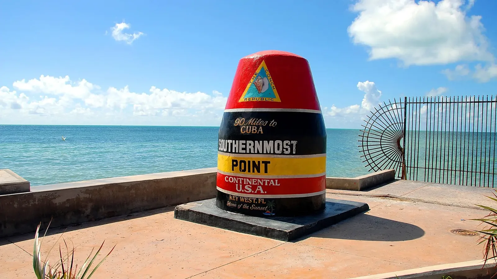
Crowds queue every day for a photo beside Key West’s famous Southernmost Point buoy. It isn’t the southernmost point of the United States, or even of Key West. The island’s true southern tip is about 900 feet away, on Navy land the public can’t enter.
Right now, you can’t even get to the buoy. It has been boxed off since September 2025 for seawall repairs, so visitors pose beside a temporary replica on Duval Street instead. You can watch both live:
LIVEWatch live →LIVEWatch live →The bigger problem is that “northernmost”, “southernmost”, “easternmost” and “westernmost” sound simple, but they depend on what counts as land. Do you mean the mainland? Any rock above water? A reef that only appears at low tide? So for each direction, we give the answer and the rule behind it.
North: Northwest Angle, Minnesota
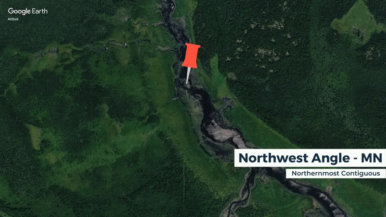
Map: Google Earth / Airbus
The northern tip of the lower 48 is a strange piece of Minnesota called the Northwest Angle, or simply “the Angle”. On a map it looks as though someone left a small piece of America sticking into Canada, and that’s not far from what happened.
The 1783 Treaty of Paris drew the border using inaccurate maps of the Lake of the Woods area, and when later agreements matched it to the real geography, a chunk of US land was left north of the 49th parallel.
The result: there’s no road to the Angle from the rest of Minnesota without driving through Canada first. North is also the only direction with one simple answer. No offshore rocks or low-tide reefs change it.
East: West Quoddy Head
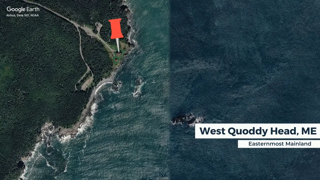
Map: Google Earth / Airbus, Data SIO, NOAA
The easternmost point of the US mainland is West Quoddy Head, Maine, home to the red-and-white striped West Quoddy Head Light. Its first lighthouse went up in 1808, during Thomas Jefferson’s presidency, and the striped tower you see today dates from 1858.
And yes, the easternmost point is called West Quoddy Head, because it sits just west of East Quoddy Head, across the water in Canada.
…unless you count Sail Rock
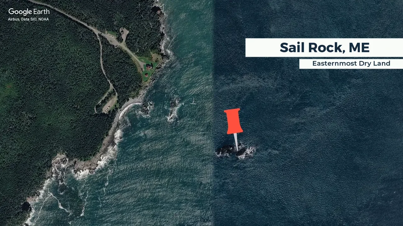
Map: Google Earth / Airbus, Data SIO, NOAA
Just offshore, Sail Rock sits slightly farther east. It’s a bare rock, with Little Sail Rock beside it on the same ledge, and it stays above water even at high tide, so if offshore land counts, Sail Rock wins. West Quoddy Head is still the one you can actually stand on.
South: Cape Sable, Florida
…or Ballast Key, or Western Dry Rocks
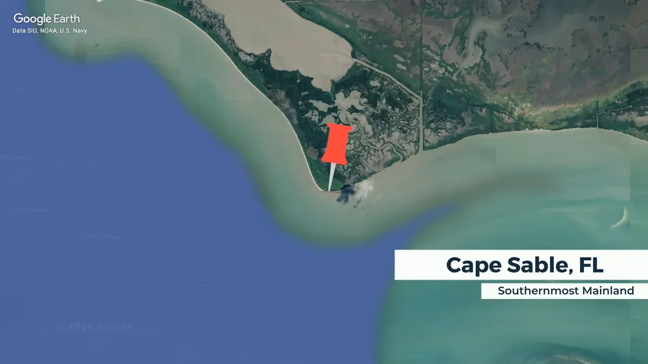
Map: Google Earth / Data SIO, NOAA, U.S. Navy
The southernmost point of the US mainland is Cape Sable, on the southwestern tip of Florida. It’s actually north of Key West, which sounds wrong until you remember Key West is an island.
Count islands, and the answer moves to Ballast Key, southwest of Key West. It’s the southernmost land in the lower 48 that stays above water at high tide, and it’s farther south than the famous buoy.
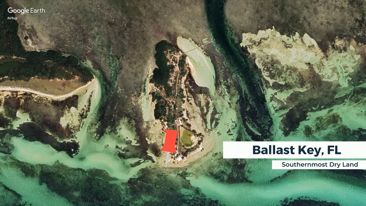
Map: Google Earth / Airbus
The map below puts it side by side with Key West.
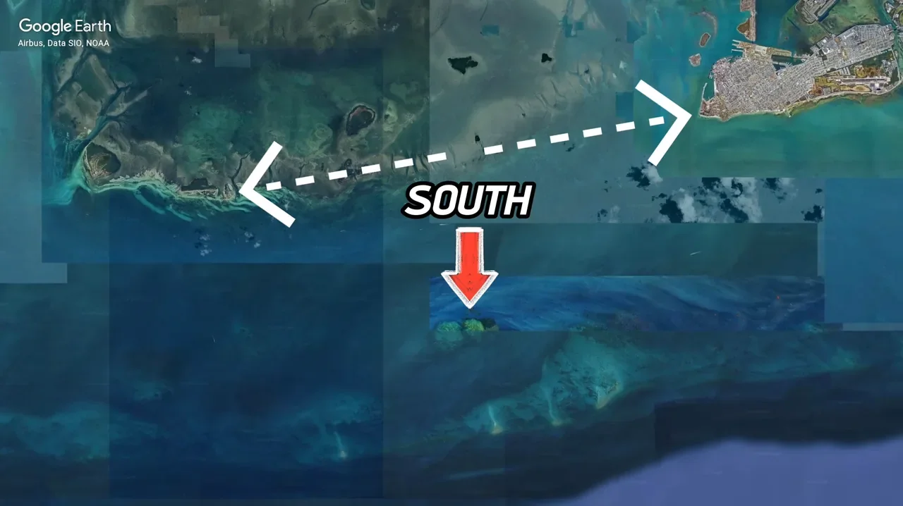
Map: Google Earth / Airbus, Data SIO, NOAA
Go one step further and count reefs that only appear at low tide, and the winner is Western Dry Rocks, a reef southwest of Key West that’s occasionally exposed by the tide.
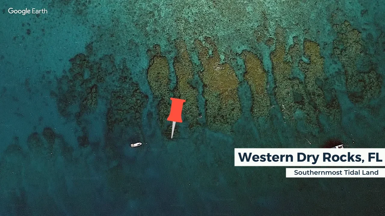
Map: Google Earth
So that’s three answers before you even get to the tourist marker. Key West’s buoy is best seen as what it was built to be: a brilliant landmark, not a survey marker.
West: Cape Alava, Washington
…or the Bodelteh Islands, or Umatilla Reef
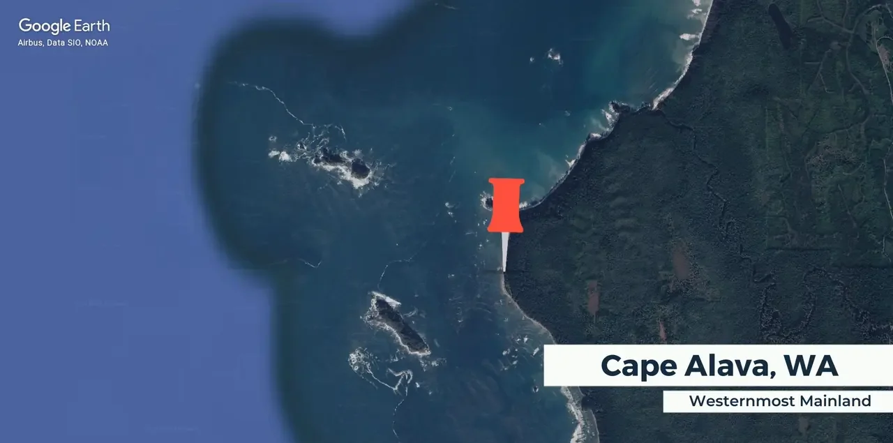
Map: Google Earth / Airbus, Data SIO, NOAA
The westernmost point of the US mainland is Cape Alava, on the wilderness coast of Olympic National Park, Washington. There’s no road to the cape and no giant sign. From the road’s end at Ozette, you walk about three miles through forest and prairie, then step out among sea stacks and tide pools.
Count offshore land, and the answer moves to the Bodelteh Islands, a small group of rocky islands just west of the cape where seabirds nest.
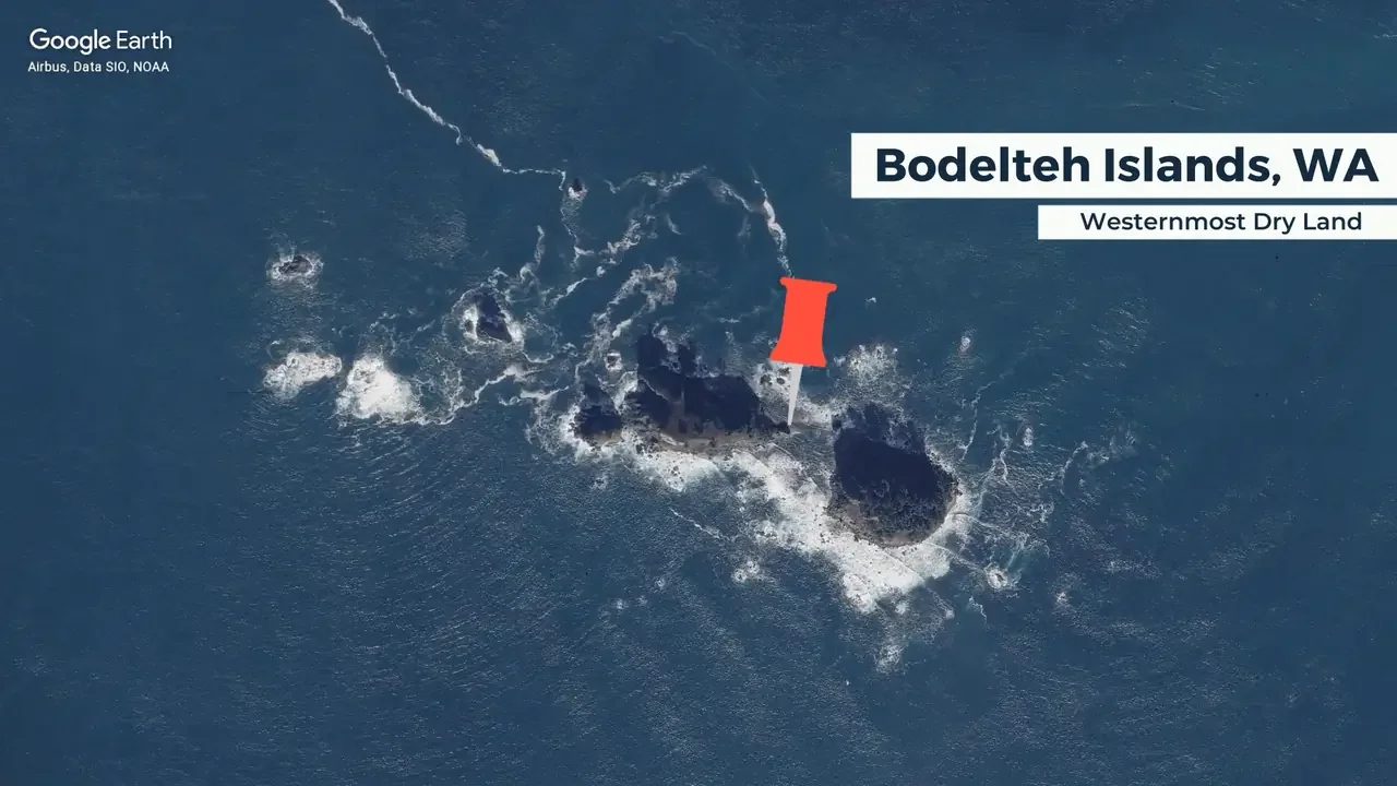
Map: Google Earth / Airbus, Data SIO, NOAA
Go one step further and count low tide, and the winner is Umatilla Reef, west of the islands, which only breaks the surface when the tide drops. West mirrors south: one mainland answer, one island answer and one low-tide answer.
Add Alaska and Hawaii
Everything so far covers the lower 48. Add the 49th and 50th states and the map changes completely.
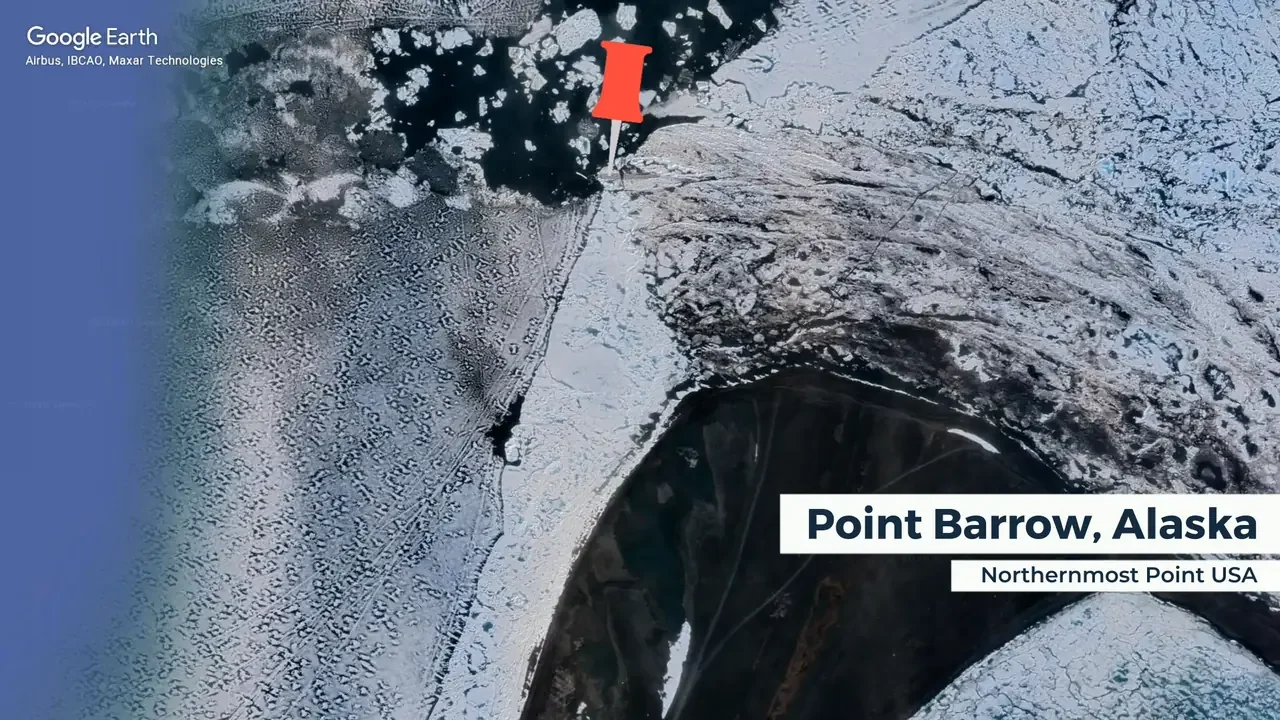
Map: Google Earth / Airbus, IBCAO, Maxar Technologies
North moves to Point Barrow, known locally as Nuvuk, on Alaska’s Arctic coast, where the Chukchi and Beaufort seas meet.
The coast here is changing fast. USGS cameras installed in 2021 were shut down in September 2025 because erosion was eating away the site.
You can catch Alaska’s northern lights live from Fairbanks:
LIVEWatch live →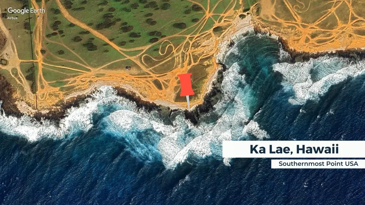
Map: Google Earth / Airbus
South moves to Ka Lae, or South Point, on Hawaii’s Big Island. The area is a National Historic Landmark, linked to some of the earliest known settlement in the Hawaiian Islands.
On the same island, Kīlauea is one of the world’s most active volcanoes:
LIVEWatch live →East Becomes West
East and west are where it gets strange. Alaska’s Aleutian Islands stretch across the 180° line, where longitude flips from east to west.
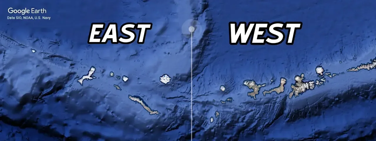
Map: Google Earth / Data SIO, NOAA, U.S. Navy
Measured the way USGS does it, by east and west longitude, the easternmost point of the United States is Pochnoi Point on Semisopochnoi Island, Alaska. The westernmost is the west point of Amatignak Island, also in Alaska. They sit on opposite sides of the 180° line, just 63 statute miles apart.
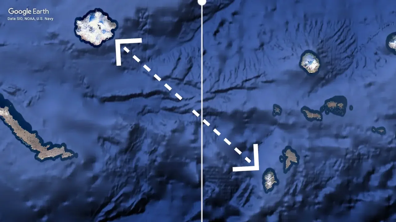
Map: Google Earth / Data SIO, NOAA, U.S. Navy
So Alaska takes north, east and west, and Hawaii takes the south.
Measure the country’s full east–west spread across the 180° line instead, and the answers change again. Sail Rock in Maine becomes the easternmost point, and Peaked Island, off Attu at the far end of the Aleutians, becomes the westernmost, or strictly, a small rock just west of it. Neither system is wrong. They just answer slightly different questions.
Where’s the Middle of America?
Finding the centre sounds easier than finding the edges, but USGS says there’s no single accepted way to calculate it. Coastlines, islands and lakes all complicate the answer.
For the lower 48, USGS puts the geographic centre near Lebanon, Kansas. The classic method treats the country like a flat cardboard cutout and finds the point where it would balance.
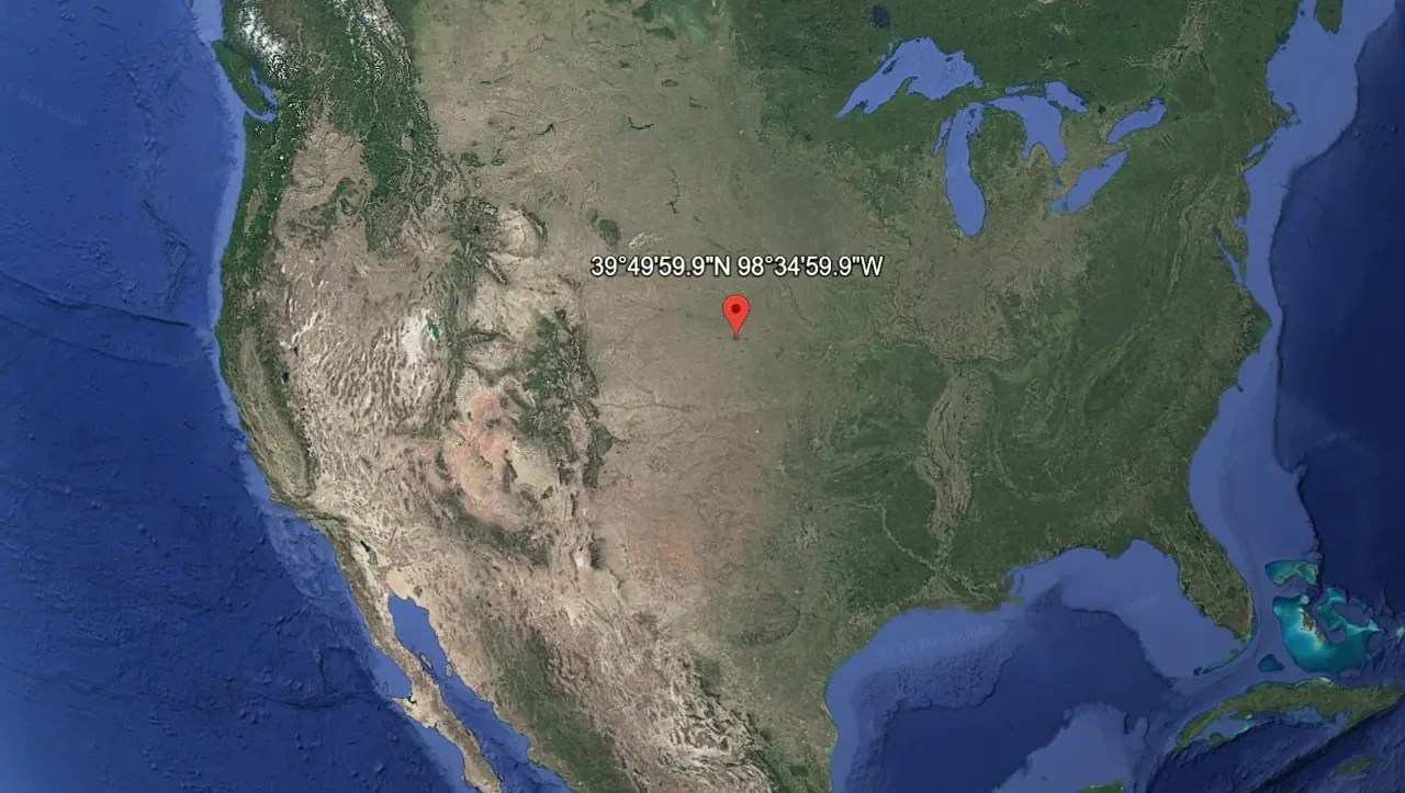
Map: Google Earth
For all 50 states, the centre moves to Butte County, South Dakota, west of Castle Rock. The nearby town of Belle Fourche has a Center of the Nation monument for visitors, but the calculated point is about 20 miles away, on private land.
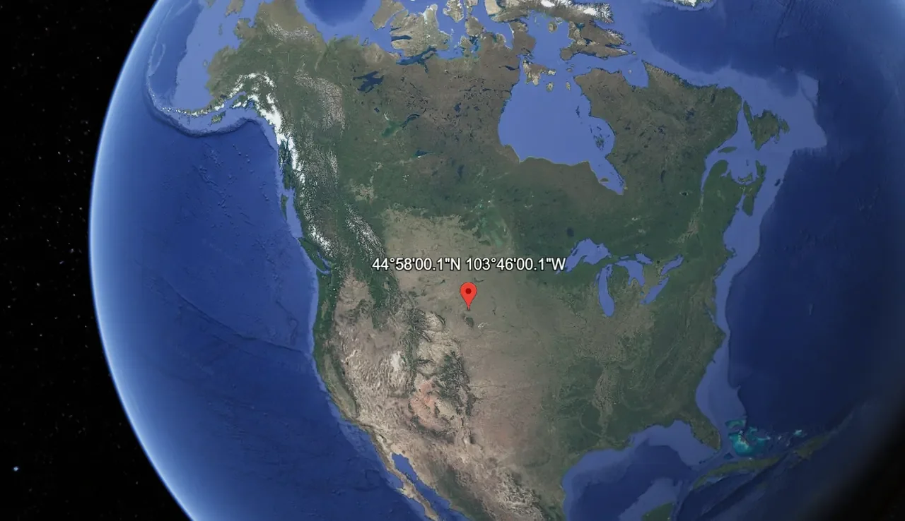
Map: Google Earth
It’s a neat echo of Key West: the marker people visit and the calculated point aren’t in the same place.
Not So Simple After All
Maps give us neat borders and tidy labels. The real world gives us islands, tides, old treaties, bare rocks, reefs and monuments built away from the points they celebrate. And that’s before you add US territories like Guam and American Samoa, which shift the answers all over again.
America doesn’t have four simple corners. It has a set of answers that change with the rules, and if you follow the map far enough, east eventually becomes west.
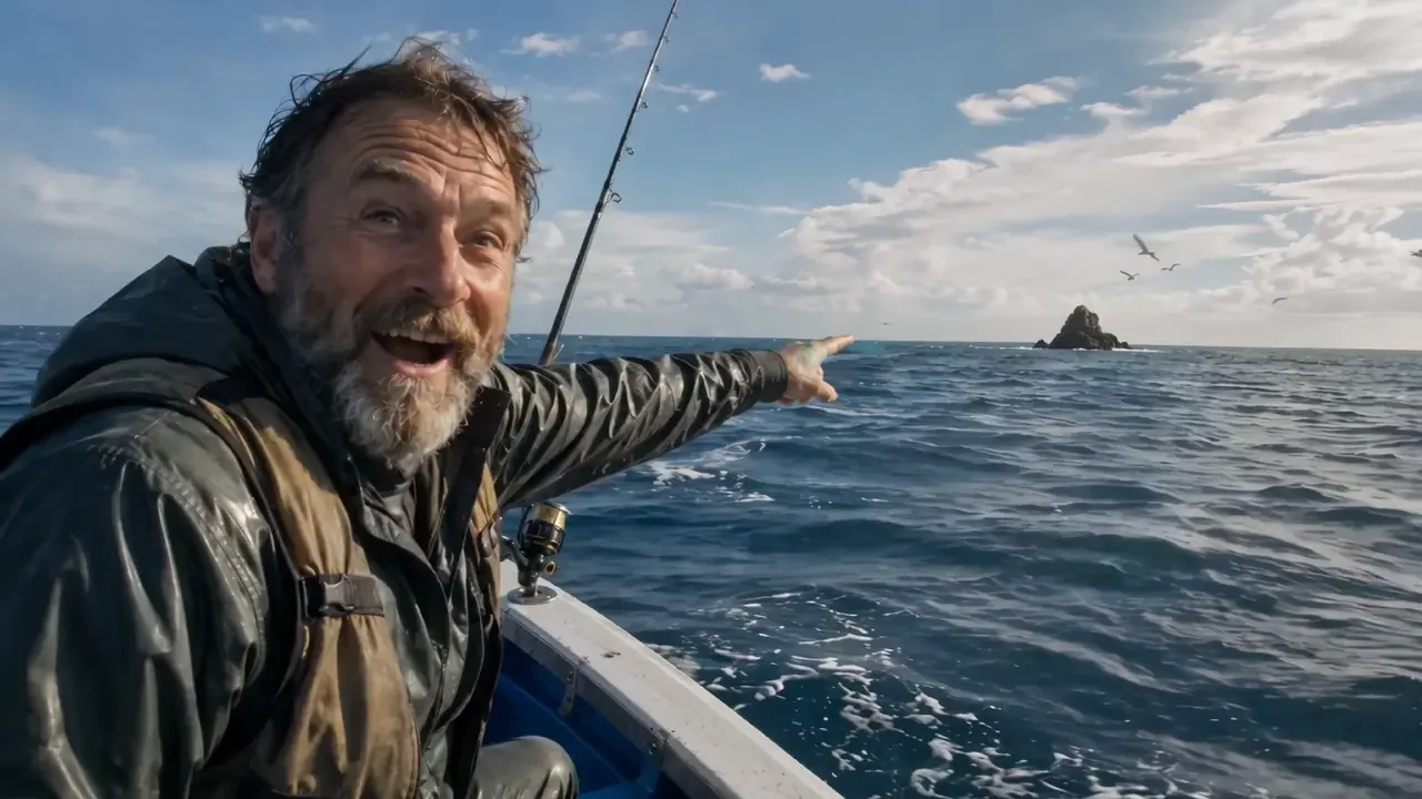
Illustration: EarthLive.TV
So unless someone finds another inconvenient rock sticking out of the ocean, these are the answers, for now.
Want more of the edges of the Earth? See the most extreme live webcams on Earth, browse every live cam in the United States, or explore the Live Webcam Map.
 Take Me Anywhere
Video Transcript 3:19
The Four Corners of America - And Why They're Not Where You Think!
Every year, millions of tourists and locals alike visit the island of Key West in Florida to get that all-important photograph at America's famous "Southernmost Point".
Just one problem: it isn't.
It isn't even the southernmost point of the island of Key West!
The real answer is much more confusing.
For the contiguous 48 US mainland states, the northernmost point is the one direction that stays simple. It is Northwest Angle, Minnesota.
For the contiguous 48 US mainland states, the southernmost point is Cape Sable, Florida.
However, the southernmost permanently dry patch of land in the lower 48 mainland US states is the island of Ballast Key - not Key West!
However, if you want to be super awkward and include land owned by the US that only appears during low tide, then the Western Dry Rocks would in fact be the southernmost point of contiguous USA.
And guess what, the same problem also applies for east and west USA.
On the east coast:
West Quoddy Head in Maine is the furthest eastern mainland point. Yes, they called it West Quoddy Head, even though it is east... ahhh, America.
However, if you count offshore rocks and islands, Sail Rock Island takes the spot.
On the west coast:
Cape Alava in Washington is the furthest western mainland point.
However, if you count offshore rocks and islands, the Bodelteh Islands take the spot.
Confusing, right? So let's add the 49th and 50th US states, Alaska and Hawaii.
Point Barrow now takes the north. Ka Lae in Hawaii takes the south.
For east and west, Alaska gets both. Why?
The Aleutian Islands cross the 180th meridian, where longitude flips from east to west.
USGS identifies Pochnoi Point as the eastern extreme and Amatignak Island as the western - and they're only 63 miles apart.
So, as you may have noticed, America doesn't really have four simple corners.
It depends whether you are counting mainland, islands, rocks, high tide or low tide... or which side of planet Earth's 180 degrees you are standing on.
So, until somebody discovers another very inconveniently placed rock within US territory, for now, those are the answers.
How this video was made
The video runs 3 minutes 19 seconds with a voiceover. Maps are Google Earth screenshots with EarthLive.TV labels, and the closing fisherman scene is an AI illustration by EarthLive.TV. Every location comes from the sources listed below.
Corrections
The transcript above is the voiceover as recorded. The article is more precise in four places: Ballast Key is an island, not part of the mainland; "permanently dry" means above water at normal high tide; the feature is called Sail Rock, not Sail Rock Island; and "millions" of visitors is a figure of speech, not a measured count.
Sources 16 sources
- U.S. Geological Survey - Distances From Extreme Points to Geographic Centers.
- U.S. Geological Survey - Geographic Centers.
- U.S. National Archives - Treaty of Paris (1783).
- NASA Earth Observatory - Northwest Angle, Minnesota.
- NOAA - U.S. Coast Pilot 1, Chapter 4, Quoddy Narrows to Calais, Maine. Sail Rock and Little Sail Rock.
- Maine Bureau of Parks and Lands - Quoddy Head State Park Guide.
- City of Key West - Southernmost Buoy. Temporary buoy installed 4 September 2025 at 1499 Duval Street.
- U.S. Fish & Wildlife Service - Key West National Wildlife Refuge.
- Florida Fish and Wildlife Conservation Commission - Western Dry Rocks.
- U.S. National Park Service - Visiting Ozette, Cape Alava and the Olympic coast.
- Washington Department of Fish and Wildlife - Periodic Status Review for the Steller Sea Lion (Bodelteh Islands and Umatilla Reef).
- NOAA - U.S. Coast Pilot 9, Alaska: Cape Spencer to Beaufort Sea. Rock about 0.3 mile west of Peaked Island, Attu.
- U.S. Geological Survey - Using Video Imagery to Study Sediment Transport and Wave Dynamics: Nuvuk (Point Barrow). Cameras decommissioned September 2025.
- Hawaii Department of Hawaiian Home Lands - South Point Resource Management Plan (South Point Complex).
- Wikipedia - Southernmost Point Buoy. True southern tip of Key West on Navy land.
- Southernmost Beach Resort (November 2025) - Southernmost Point Buoy temporary location and reopening timeline.
Editor's note
Links verified 26 August 2026; buoy, Point Barrow camera and Peaked Island details checked October 2026. Maps are Google Earth screenshots with EarthLive.TV labels. The fisherman picture is an AI illustration made by EarthLive.TV.
How we researched this article
The USGS table is the main reference for the standard 48- and 50-state extreme points. Offshore and low-tide answers are labelled separately because they are not all part of the standard USGS table; for those edge cases, agency data and NOAA nautical publications were cross-checked against detailed geographic compilations. Offshore map links are approximate Google Maps positions.